
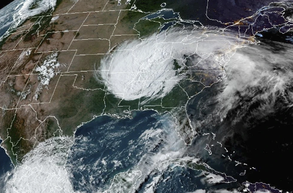
The remnants of Hurricane Helene will continue to languish over western Kentucky through the weekend with diminishing rainfall and slowing wind speeds.
The center of the tropical depression is over the Ohio River near Owensboro today and Sunday, bringing an end to its westward movement.
Widespread showers with some heavy rain will continue through this evening. Showers will be more isolated on Sunday.
The Flood Watch and Wind Advisory remain in effect due to conditions from the remnants of Helene.
After 6 inches or so in many areas, an additional 1 or 2 inches of rain is possible through Sunday.
Winds from the north-northwest will continue around 25 miles per hour today, then taper off Saturday night and Sunday.
The Quad State will finally begin to dry out on Tuesday as a cold front pushes Helene out of our area. Dry weather returns for the remainder of the new week as temperatures warm back into the 70s Monday and lower 80s on Tuesday.
(Satellite photo - NOAA)
Advertisement
Helene remnants keep spinning over western Kentucky all weekend
Advertisement
Latest Local & Regional
Local & Regional
an hour ago

Local & Regional
4 hours ago
Local & Regional
6 hours ago

Local & Regional
15 hours ago

Local & Regional
22 hours ago

ADVERTISEMENT
Most Read >
ADVERTISEMENT
Latest Local & Regional
Local & Regional
an hour ago
Local & Regional
4 hours ago
Local & Regional
6 hours ago
Local & Regional
15 hours ago
Local & Regional
22 hours ago
Advertisement
ADVERTISEMENT