
The National Weather Service's latest extended outlook puts us dead center in a dozen-state circle that will see the highest probability of very hot temperatures for the next ten days.
Virtually everyone this side of the Rocky Mountains can anticipate warmer than normal temps, but the heat will really build into the mid-Mississippi and lower Ohio valleys next week with highs in the upper 90s by Wednesday and Thursday.
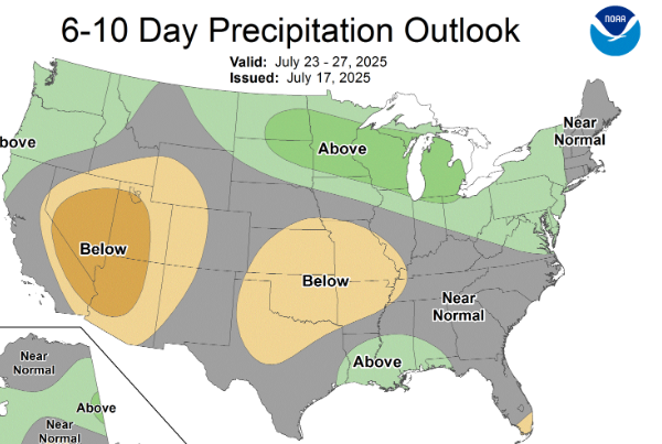
Our pattern of daily storm chances will continue Friday and peak through the weekend, but the 10-day outlook for precipitation is actually below average, according to the Climate Prediction Center.
However, there'll be plenty of humidity next week to push heat index levels into advisory or warning levels.
Advertisement
Plenty of heat baked into our 6-10 day forecast
Advertisement
Latest Local & Regional
Local & Regional
2 hours ago
.jpg?lang=en-US&width=200&height=200&ext=.jpg)
Local & Regional
3 hours ago

Local & Regional
7 hours ago
Local & Regional
9 hours ago

Local & Regional
11 hours ago

ADVERTISEMENT
Most Read >
ADVERTISEMENT
Latest Local & Regional
Local & Regional
2 hours ago
Local & Regional
3 hours ago
Local & Regional
7 hours ago
Local & Regional
9 hours ago
Local & Regional
11 hours ago
Advertisement
ADVERTISEMENT