
The National Weather Service has issued a heat advisory for the majority of our region this afternoon, in effect from 11 a.m. until 8 p.m.
Dangerous heat index values could reach 105 to 110 degrees depending on the timing of afternoon thunderstorm development. Stay hydrated and take plenty of breaks in the shade if you'll be outdoors.
Celebrations on the Fourth of July Thursday look to be hot, humid, and stormy. Expect scattered storms through much of the day and evening. Outside of the storms it will be steamy, with triple digit heat index values in the afternoon.
Multiple rounds of heavy rain are possible today through Friday afternoon, with the greatest potential for flooding issues later this afternoon and evening, then again Thursday afternoon and night. Right now, the heaviest band of 2 to 4 inches of rain looks to fall across parts of southeast Missouri into southern Illinois. Isolated flash flooding will be possible in places.
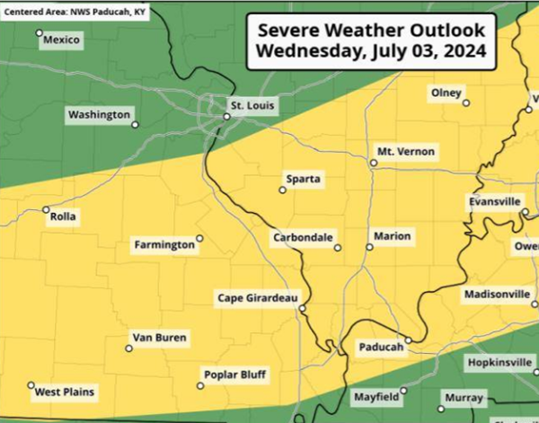
The primary severe weather hazard is damaging winds. Heavy rain and frequent lightning are also expected.
Advertisement
Heat advisory this afternoon; storms still likely on the 4th
Advertisement
Latest Local & Regional
Local & Regional
2 hours ago

Local & Regional
3 hours ago

Local & Regional
21 hours ago

Local & Regional
21 hours ago

Local & Regional
22 hours ago

ADVERTISEMENT
Most Read >
ADVERTISEMENT
Latest Local & Regional
Local & Regional
2 hours ago
Local & Regional
3 hours ago
Local & Regional
21 hours ago
Local & Regional
21 hours ago
Local & Regional
22 hours ago
Advertisement
ADVERTISEMENT