The National Weather Service in Paducah issued data for the completion of meteorological fall (September, October and November) which reveals that many locations got only about half of the usual rainfall for the period. However, the deficit was not enough to break into Paducah's top ten driest falls.
Normal precipitation ranges from 10-13 inches, but much of southern Illinois saw only 4-6 inches. Paducah received 5.01 inches; Benton 6.8; and Murray 7.18 over the three months.
Trigg and Christian counties were the only ones to reach double digits in rainfall.
Rain was especially sparse in November. Southern Illinois saw less than two-thirds of an inch for the entire month, and western Kentucky was generally in the 1-to-2 inch range. November usually brings 4 to 5 inches of rain across the region.
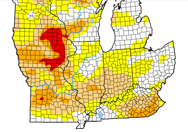
The rain deficit has resulted in virtually all of southern Illinois to be classified as abnormally dry, the first of the five-level USDA Drought Monitor chart. Drought conditions intensify to severe levels in central Illinois.
Fall always brings a wide range of temperatures to the region. Paducah's hottest autumn afternoon was 91 degrees on Labor Day September 4, and the coldest morning was 24 on November 28. Overall, it was Paducah's 7th-warmest fall since records were kept beginning in 1938.
On the Net:
Full report - Fall climate summary


