
The weather service emphasizes this is a very active, very dangerous weather pattern. Potentially historic rainfall will begin this afternoon, ushered in by winds gusting to 45 to 55 miles per hour outside of thunderstorms.
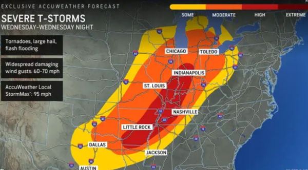
The strong supercells could contain large to very large hail, damaging winds over 60 miles per hour, and the potential for strong EF-2 or higher long-track tornadoes.
Some level of severe storm risk will continue through Saturday.
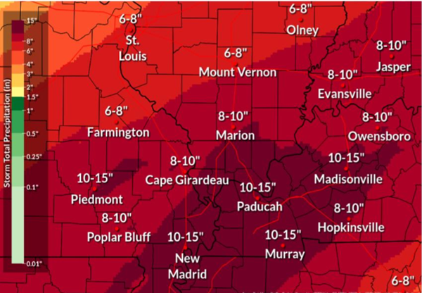
Numerous rounds of heavy rain will continue into Saturday night. An atmospheric river will push repeated rounds of thunderstorms along the Ohio River valley. The estimate still holds for at least 7 to 10 inches of rain, with 10 to 12 inches or more possible in many areas.
This will lead to potentially dangerous and life-threatening catastrophic flooding. A flash flood watch has been issued for the Quad State area through Saturday.
Flash flooding will occur in places that do not usually flood, even some that have never flooded before. Homes and businesses can be inundated, and some roads can wash out.
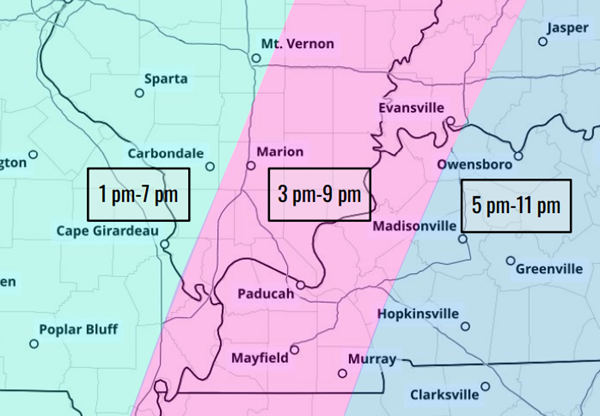
The atmosphere is expected to be the most favorable for this from about 4-10 pm. Forecasters add the risk for flash flooding will likely start around 9-10 pm.
Into the weekend, runoff will cause some river flooding to occur.
The full briefing by the National Weather Service office in Paducah can be viewed here .
On the Net:
National Weather Service webpage


