
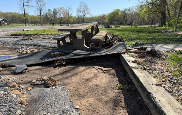
The flooding that closed and damaged dozens of roads across western Kentucky has had the same impact on the Land Between the Lakes recreational area, even more so along its gravel roads and dirt trails.
Road assessments continue across LBL. The Woodlands Trace was reopened fairly quickly, but many side roads remain closed until they can be inspected and repaired.
Roads with minimal impacts are being reopened, but barricades remain at roads with high water, damage or downed trees.
Road 134 from 68/80 to Mulberry Flats is being repaired and may take longer to open than other roads.
Energy Lake Campground is also closed. Other closed locations include:
Gatlin Point Campground
Bards Dam Road
FS Road 165 south of Wranglers Campground to Woodlands Trace.
FS Road 360, FS Road 207, FS Road 139, FS Road 112.
Phone lines are down at Wranglers Campground
Even if they have been opened, many roads still have considerable damage and a 4WD vehicle is recommended on gravel roads.
Crews will begin assessing cemetery access and trails next.
Photo: Crews clear a large tree from Canal Loop Scenic Drive. (LBL Facebook)
Advertisement
LBL opening gradually, but still lots of road damage and trees down
Advertisement
Latest Local & Regional
Local & Regional
an hour ago

Local & Regional
8 hours ago

Local & Regional
11 hours ago

Local & Regional
12 hours ago

Local & Regional
12 hours ago

ADVERTISEMENT
Most Read >
ADVERTISEMENT
Latest Local & Regional
Local & Regional
an hour ago
Local & Regional
8 hours ago
Local & Regional
11 hours ago
Local & Regional
12 hours ago
Local & Regional
12 hours ago
Advertisement
ADVERTISEMENT