
Scattered severe thunderstorms tonight could contain hail and damaging wind gusts. Isolated tornadoes cannot be ruled out.
A flash flood watch is also in effect until Sunday evening.
Another round of strong to severe thunderstorms will also be possible again on Sunday afternoon and evening. Large hail and damaging winds, along with the possibility of isolated tornadoes will again be a concern on Sunday.
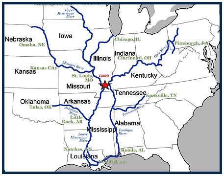
The National Weather Service in Paducah has issued a

* Flash Flood Watch for portions of southern Illinois, western
  Kentucky, and southeast Missouri, including the following
  areas, in southern Illinois, Alexander, Edwards, Franklin,
  Gallatin, Hamilton, Hardin, Jackson, Jefferson, Johnson,
  Massac, Perry IL, Pope, Pulaski, Saline, Union, Wabash, Wayne
  IL, White, and Williamson. In western Kentucky, Ballard,
  Carlisle, Fulton, Hickman, and McCracken. In southeast
  Missouri, Bollinger, Butler, Cape Girardeau, Carter,
  Mississippi, New Madrid, Perry MO, Ripley, Scott, Stoddard,
  and Wayne MO.

* From Friday evening through late Sunday night

* The watch is generally in effect for locations along and west of
  a line extending from near Fulton, Kentucky to Mount Carmel,
  Illinois, including all of southeast Missouri. Much of this
  region has already received 1.5 to 3 inches of rainfall in the
  past 12 to 18 hours. Though things may tend to dry out a bit
  today and Friday, numerous thunderstorms with very heavy rain
  are expected to develop Friday night and then again Saturday
  night, Sunday and Sunday evening. There may be a break in the
  heavy rain threat during the day Saturday over western Kentucky,
  southwest Indiana, far southeast Missouri and the southern tip
  of Illinois. Several inches of rain are expected before all is
  said and done late Sunday night. The highest amounts are
  expected to fall from southeast Missouri into southwest
  Illinois.

* In addition to the possibility of flash flooding, the heavy
  rainfall is expected to cause rises on many of the area rivers,
  particularly the smaller rivers in southeast Missouri such as
  the Saint Francis, Black, and Current.
On the Net:
Paducah Weather Service webpage

.jpg)
.jpg)